The file › Getting here
Getting to the Crest: four ways in, one bluff
By plane and city ferry, by BC Ferries, by train from Jasper or by Highway 16. Every route ends on 1st Avenue West.
The address and the last turn
The hotel's address is 222 1st Avenue West, Prince Rupert, BC V8J 1A8. Its own directions are short: follow Highway 16 into town to the harbour view on 1st Avenue, turn left, and the Crest is on the bluff overlooking the harbour (source: cresthotel.ca, Prince Rupert). Parking is complimentary for guests, with covered options.
- 8.4 kmPrince Rupert Airport (YPR)Straight line across the harbour; in practice a bus and the Digby Island ferry.
- 3.4 kmBC Ferries terminal and VIA Rail stationOne building; the hotel quotes a 10-minute taxi ride.
- 692 mHighliner Plaza, 815 1st Ave WWhere the airport bus starts and finishes downtown.
- 536 mCow BayThe marina and the Cow Bay shopping district.
- 107 mChances Prince RupertNext door along 1st Avenue West.
By air
Prince Rupert's airport sits on Digby Island, on the far side of the harbour. The hotel says daily flights connect it with Vancouver International (YVR), and that a short ferry ride brings you to the downtown shuttle, four blocks from the Crest. The airport authority's schedule from 25 October 2026 shows Air Canada flight AC 8090 daily, with the airport bus leaving downtown at 12:00 and arriving back downtown at 14:45 (source: ypr.ca). The Digby Island Ferry is run by the City of Prince Rupert, and the passenger fare is included in airline tickets (source: ypr.ca, Digby Island Ferry). The authority asks passengers to be ready to board ten minutes before the scheduled time.
Opinion: on arrival day, treat the bus and ferry as part of the flight. Build in the full time to downtown before booking a dinner table.
By sea
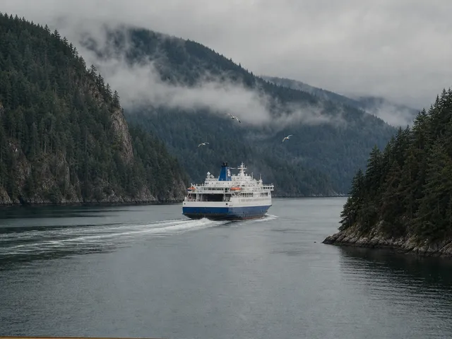
Prince Rupert is the northern terminus for BC Ferries, with sailings to Port Hardy on Vancouver Island and to Haida Gwaii, and the Alaska Marine Highway also calls here, according to the hotel. BC Ferries describes the Port Hardy to Prince Rupert run as a 16.5-hour scenic sailing (source: bcferries.com). From the ferry terminal to the hotel, the hotel quotes a 10-minute taxi ride. The full story of that sailing is on the Inside Passage sheet.
By rail
VIA Rail's Jasper – Prince Rupert train covers 1,177 km, with an average journey time of one day, 10 hours and 40 minutes, via Prince George (source: viarail.ca). The Prince Rupert station is inside the BC Ferries terminal, a short taxi ride from the Crest. The train follows the Skeena River on the last stretch to the coast.
By road
Prince Rupert sits at the western end of Highway 16. The hotel calls the corridor one of the most captivating drives in British Columbia, following the Skeena, one of the great salmon rivers and among the largest undammed river systems on the continent. The section between Terrace and Prince Rupert opened on 4 September 1944, during the Second World War (source: Wikipedia). In town, taxis and rental cars are available, the hotel says.
Maps and routes
Each link opens a route in Google Maps to the Crest, 222 1st Avenue West. Times shown there are Google's estimates, not mine.
- Directions from Prince Rupert Airport (YPR)
- Directions from the BC Ferries terminal and VIA Rail station
- Walking route from the airport bus stop at the Highliner
- Driving route from Terrace on Highway 16
- Driving route from Prince George
- Walking route from Cow Bay
- Walking route from the Crest to Chances
The map shows the Crest Hotel at 222 1st Avenue West, Prince Rupert, BC V8J 1A8. It is served by Google Maps, which receives your IP address when it loads; see privacy. Open in Google Maps.